Limitations
The models provide an estimate of geological units and properties for an area of 100 x 100 m, fitting a subregional scale. Therefore, a synthetic borehole may deviate from the actual borehole log at the same location.
The elevation of the surface level at the location of a borehole may deviate from the top of the model. This may have several causes: small variations of the surface level near the location of the borehole, errors in the measurement of the surface level, or a real change in surface level as a result of for example, excavation activities.
To create a model a snapshot has been made of the boreholes in the DINO database. Therefore, all changes in the DINO database made after the snapshot will not be incorporated in the model at hand. The Subsurface data module does not use snap shots, so it provides the data as they are stored in the DINO database at present. This may cause differences in the data shown for the same borehole in the two modules.
Availability
In the module Subsurface models only the publically available borehole are shown that are used to create the model. We also used confidential boreholes and borehole data from Utrecht University. These boreholes are not displayed and cannot be ordered at DINOloket.
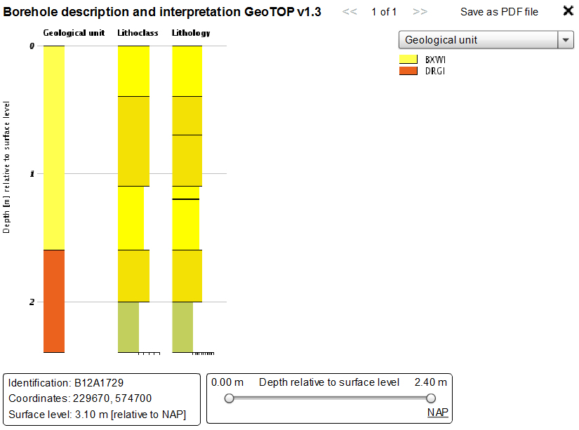
Example of a visualisation of a borehole log used in the GeoTOP model
View and save
The borehole log and additional interpretations can be viewed and saved in Step 1.