Hovering over the cross section gives you access to maps showing the top, base or thickness of the selected model unit. In addition maps of the hydraulic properties (REGIS II) provide a spatial view of the hydraulic conductivity of the model unit. Combining the cross-sections with these maps help to capture the 3D aspects of the structure and properties of the subsurface.
Limitations
Map images can only be displayed from a cross section. The map is a static image that can not be zoomed or panned.
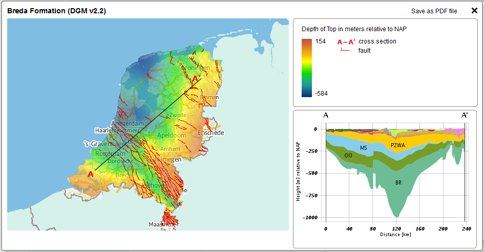
Example of a map showing the top of the Breda Formation in DGM
View and save
Maps of the model units can be viewed and saved in Step 1.