In step 1 “Search and View” the user can create a random cross section through the model, cores at random locations, and the user can view well stratigraphy. A map view can be selected after defining a random cross section and handling the mouse-over over the cross section.
Well Stratigraphy
Below an example is given of a visualisation showing well stratigraphy and the stratigraphic units interpreted at group level. A side-tracked well has multiple pages.
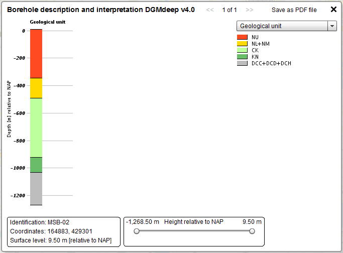
Example of a visualisation of the well stratigraphy
Synthetic borehole
Click on a random location in the model area to generate a visualisation of the model at that point. The synthetic borehole provides depth and thickness relations of the stratigraphic units at the selected location. The user can switch between NAP (Dutch Ordnance Level) and ground level as a reference.
Deliverables
Model units are available in 2 formats: ARCGIS and ZMAP. Depth and thickness maps of the model units are included in pdf-format. For each stratigraphic interval, several data types can be downloaded. Table 2 provides a listing of the available grids per stratigraphic unit
Table 2
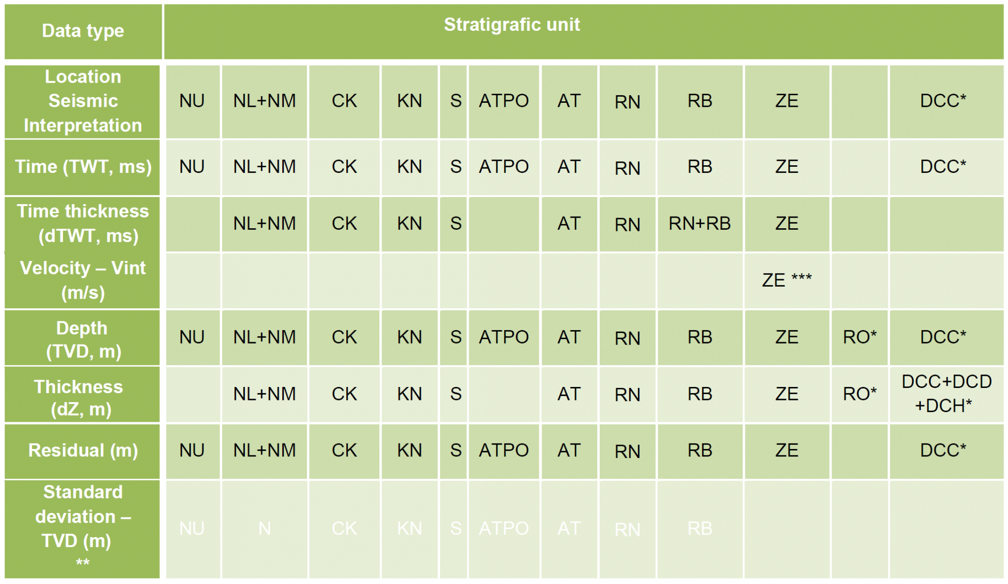
* Grids of the Upper Rotliegend Group have only been published in the projection system ED50-UTM31. Grids of the Carboniferous horizons have only been published in RD-Bessel 1841
** Standard deviation grids will be released at a later date.
***ZE-Vint : Velocity grid used is slightly different compared to Velmod-3.1. ZE- Vint grid