The SubsurfaceViewer provides an understanding into the modelled geometries and characteristics of the subsurface of the Netherlands using maps, borehole logs, cross-sections and full 3D views.
Specification
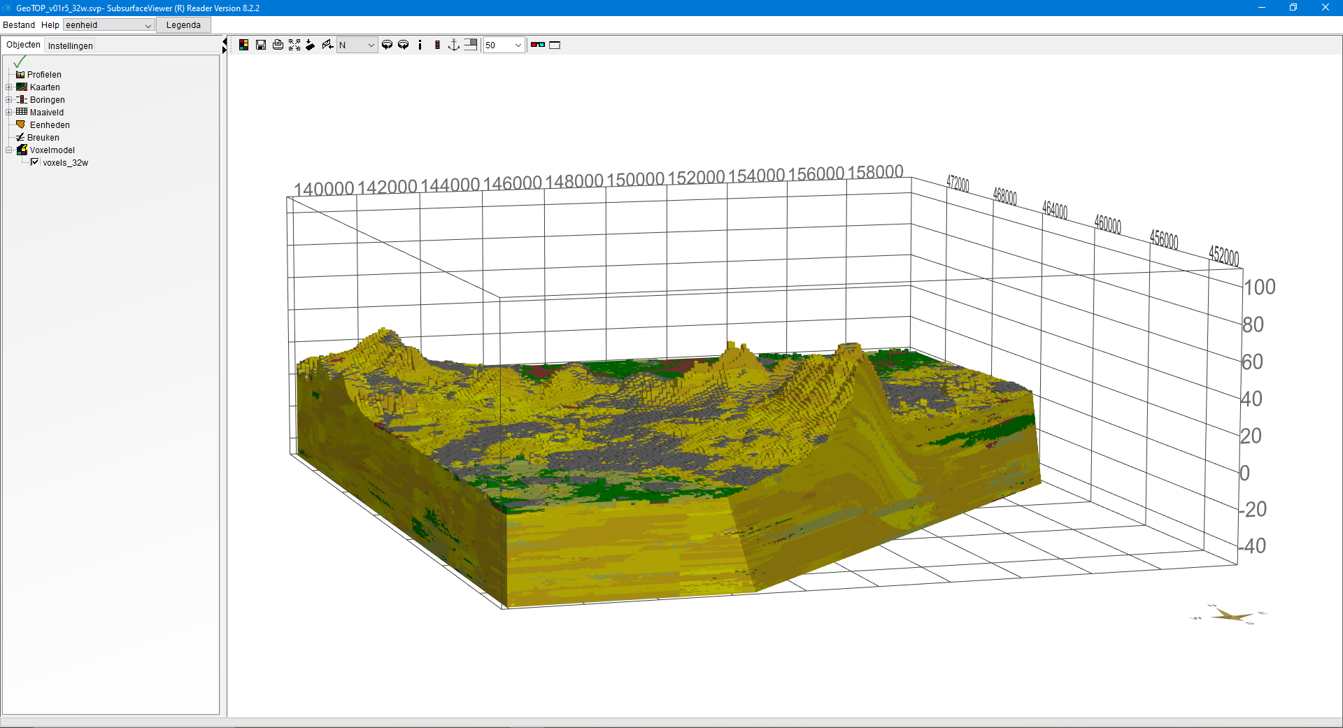
The SubsurfaceViewer is a standalone Windows software package to visualize the subsurface models DGM, REGIS II, GeoTOP and DGMdeep in 2D and 3D. This application has been developed for TNO by the German firm INSIGHT Geologische Software Systeme GmbH (www.subsurfaceviewer.com). TNO makes this software available free of charge. When SubsurfaceViewer files are requested via DINOloket, the program installer and the manual (Dutch) are always included. For SubsurfaceViewer to function properly, your laptop or PC's graphics card should support at least the Open Graphics Library (Open GL.1.2).
Functionalities
The current version of the SubsurfaceViewer includes an advanced tool to interactively create cross-sections through the 3D representation of the models. For example, you can move ('slice') a cross-section line through the model in any desired orientation. Or create a section and drop the front part of the model so that you can see the profile plane and the 3D model behind it. This interactive view gives a good insight into the 3D structure of the subsurface.
An arbitrary profile can be drawn on the map (multiple vertices possible), which is displayed in the cross-section pane. This profile line can, for example, follow the route of a road, dike or pipeline. The vertical scale can be adjusted completely to your specifications.
Using the advanced mode, it is possible to add own data and view them in conjunction with the model data, with various analysis tools available. The set of own data and model data can be stored and saved as a new SubsurfaceViewer project. Further information on the functionalities of the software can be found in the SubsurfaceViewer 3D manual (TNO, 2022, Dutch) that comes with the software.
Datasets - both map sheets and nationwide
SubsurfaceViewer files are delivered in predefined map sheets of 20 x 25 km, in accordance with the map sheet layout of Top50raster of Kadaster.nl. For DGM, REGIS II and DGMdeep (onshore) also national SubsurfaceViewer files are available.
The delivered zip files contain a .svp file to use in the SubsurfaceViewer. For REGIS II the SubsurfaceViewer files also include DGM. In the viewer you can switch between the two models. The GeoTOP zips also include the voxelmodel in ASCII format.
Request
The SubsurfaceViewer itself and the .svp files can be requested after choosing the download option of DGM, REGIS II, GeoTOP of DGMdeep in the map viewer of DINOloket.