In the latest version of the BRO-GeoTOP model, Geological Survey of the Netherlands (part of TNO) has replaced the Zeeland and Goeree-Overflakkee model areas with an entirely new combined model area 'Zeeland and Goeree-Overflakkee'.
GeoTOP is a 3D model of the shallow subsurface of the Netherlands. In it, the subsurface is subdivided into millions of voxels (blocks) measuring 100 x 100 x 0.5 m. Each voxel contains several attributes that provide information on stratigraphy (layer structure) and lithological class (soil type, e.g. sand, clay or peat). The model estimates these attributes based on hundreds of thousands of borehole descriptions from DINO and BRO.
Zeeland and Goeree-Overflakkee
Zeeland and Goeree-Overflakkee were published back in 2008, making them the oldest two model areas of GeoTOP. Since then, a lot of new borehole data has become available. The geological insights of the area have also changed in the meantime. The new model incorporates the new boreholes and insights and also applies the latest modelling techniques.
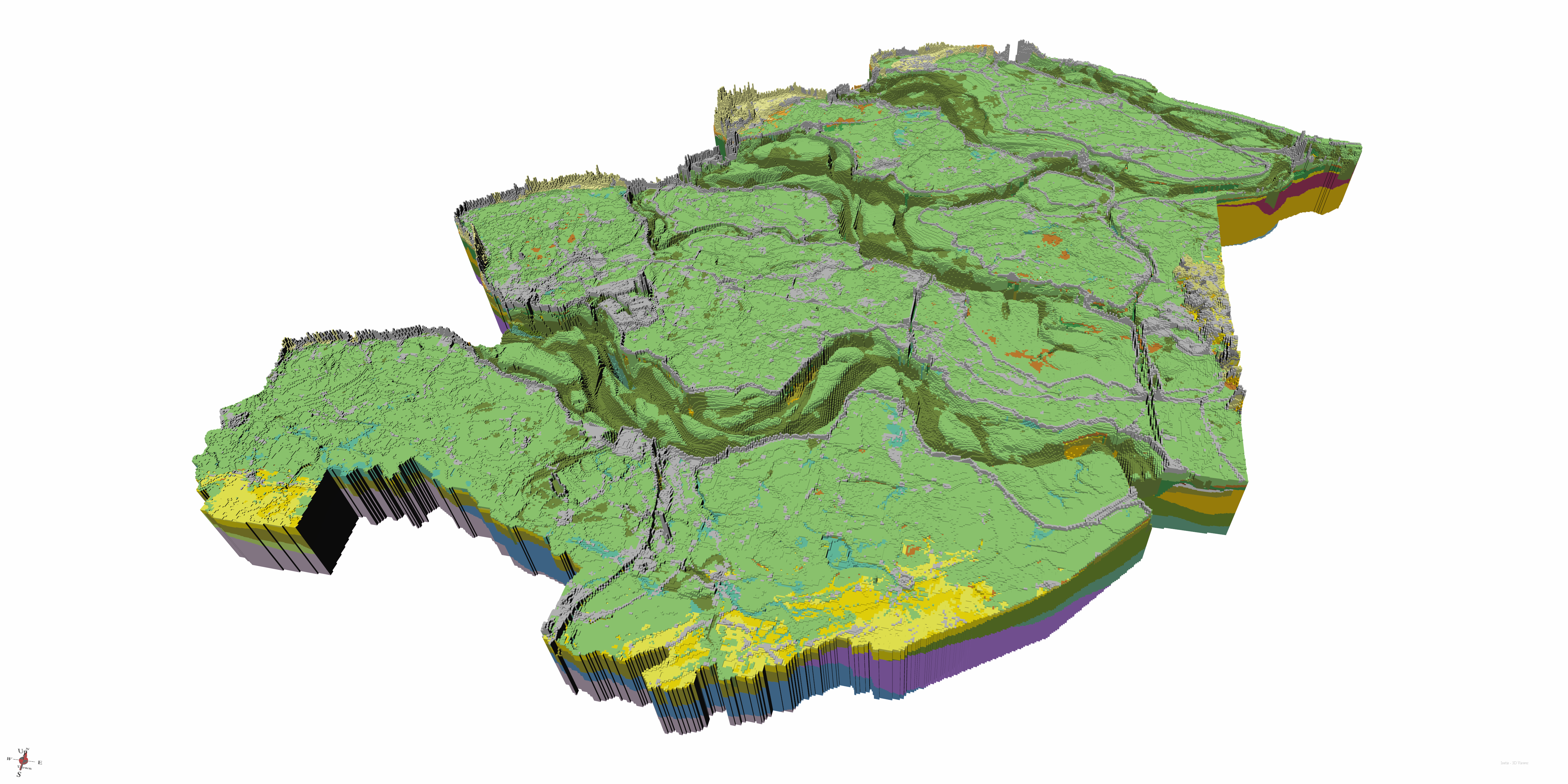 3D view of Zeeland and Goeree-Overflakkee. The colours represent the stratigraphic units. The vertical scale is 100x exaggerated.
New borehole data
Some 23,500 borehole descriptions were used in the old model areas (22,000 in Zeeland and 1,500 in Goeree-Overflakkee). These boreholes were largely manually interpreted in stratigraphic units. The new model area uses 41,500 borehole which, as in the other parts of GeoTOP, have been interpreted automatically with software.
New geological insights
The deposits of the Scheldt are included in the model as separate stratigraphic units. These are the Pleistocene deposits of the Koewacht Formation and the Holocene deposits of the Kreekrak Formation. Furthermore, much attention has been paid to the complex stratigraphic relationships in the coastal area, especially in the Kop van Schouwen.
New modelling techniques
Zeeland and Goeree-Overflakkee benefit from the new method of layer modelling first applied in North Brabant and North and Central Limburg. In addition, the lithological class (soil type) in the voxel model was modelled for Zeeland and Goeree-Overflakkee using a new, improved method.
Want to know more?
View or download the BRO model GeoTOP v1.5 on the DINOloket map. More information about GeoTOP can also be read on the Explanation page. The model is accompanied by a conceptual model, a realisation report and a quality assessment document. These documents are included with the download of the model.