The free SubsurfaceViewer enables 3D viewing and usage of the DGM, DGMdeep, REGIS II and GeoTOP subsurfacemodels locally, on your personal computer. The latest version of SubsurfaceViewer includes new features that makes using the models even easier.
3D viewer for local use
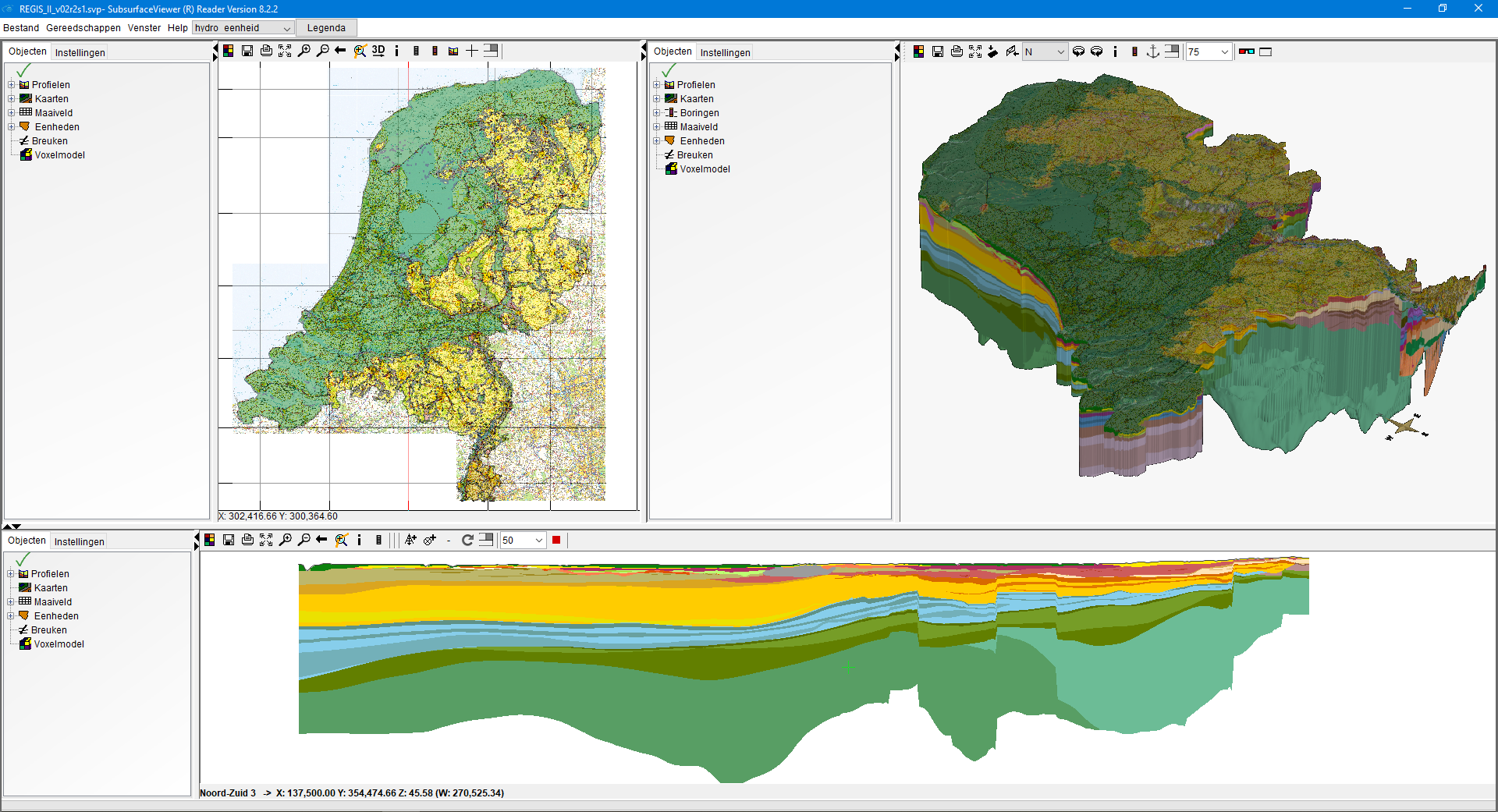
The SubsurfaceViewer application is designed for visualisation of the subsurface models DGM, REGIS II, GeoTOP and DGMdeep. The software has a several viewers including: a map viewer , (synthetic) boreholes and cross section profiles and a 3D viewer. The SubsurfaceViewer is a powerful tool to provide insight into the geometry and properties of the Dutch subsurface.
Additional possibilities
Together with our supplier, German firm INSIGHT Geologische Software Systeme GmbH, TNO has developed a new version of the application. The new version includes an advanced cross-section tool that allows interactive creation of cross sections through the 3D representation of the models. Another important innovation is that DGM and REGIS II can be viewed in their entirety (nationwide) in 3D. Furthermore it is now possible to add your own data.
‘Slice’ through the model
The new cross-section tool allows you to draw a profile line in the 3D viewer. The part in front of the profile line is removed and the portion of the model behind the line remains. The ‘slice’ can be moved freely and this provides a powerful tool to get insight into the 3D structure of the subsurface.
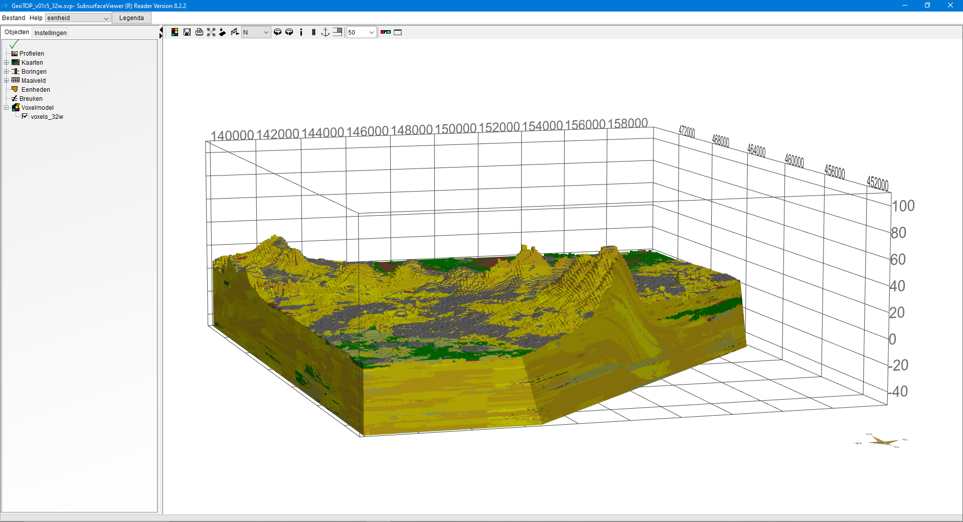
DGM and REGIS II nationwide
The new files DGM_v02r2.svp and REGIS_II_v02r2s1.svp allow for a nationwide display of these models in 3D. Zooming and selecting sub areas and making cross section is now also possible. Usage is no longer restricted to the model blocks of 20x25km.
Add your own data
The advanced mode allows you to add your own data and view it together with the model data. Also new analysis tools have been added. The set of own data and model data can be saved as a new SubsurfaceViewer project on your own computer.
Request SubsurfaceViewer DINOloket
The new version of the SubsurfaceViewer (including instruction manual) can be requested through DINOloket. TNO supplies the application available free of charge. You can find the application if you choose to download one of the models DGM, REGIS II, GeoTOP or DGMdiep. Previously downloaded subsurface model datasets can also be viewed in the new version of SubsurfaceViewer.
Want to know more?
Reed the renewed manual (Dutch) of the SubsurfaceViewer.