In the latest version of the REGIS II model (v2.2.1), TNO's Geological Survey of the Netherlands has added uncertainty information to the top, base and thickness of mapped hydrogeological units. This is a valuable addition for groundwater management and related groundwater research.
REGIS II is a 3D model of the layer structure and hydraulic properties of the subsurface of the Netherlands up to a depth of about 500 m, with a maximum depth of 1,200 m in the Roer Valley Graben. REGIS II is based on hydrogeological interpretations of borehole descriptions and the DGM layer model. In REGIS II, DGM's lithostratigraphic units are further subdivided into hydrogeological units.
Uncertainties
Uncertainties of hydraulic conductivity where already present in REGIS II. In the current release, uncertainties of the geometry are added. The newly added uncertainty grids show for each grid cell the model uncertainty of the geometry, expressed as a standard deviation (m). With the standard deviation, it is possible to determine the probability that the depth or thickness of a mapped boundary surface shows a certain deviation from the most probable value estimated by the model.
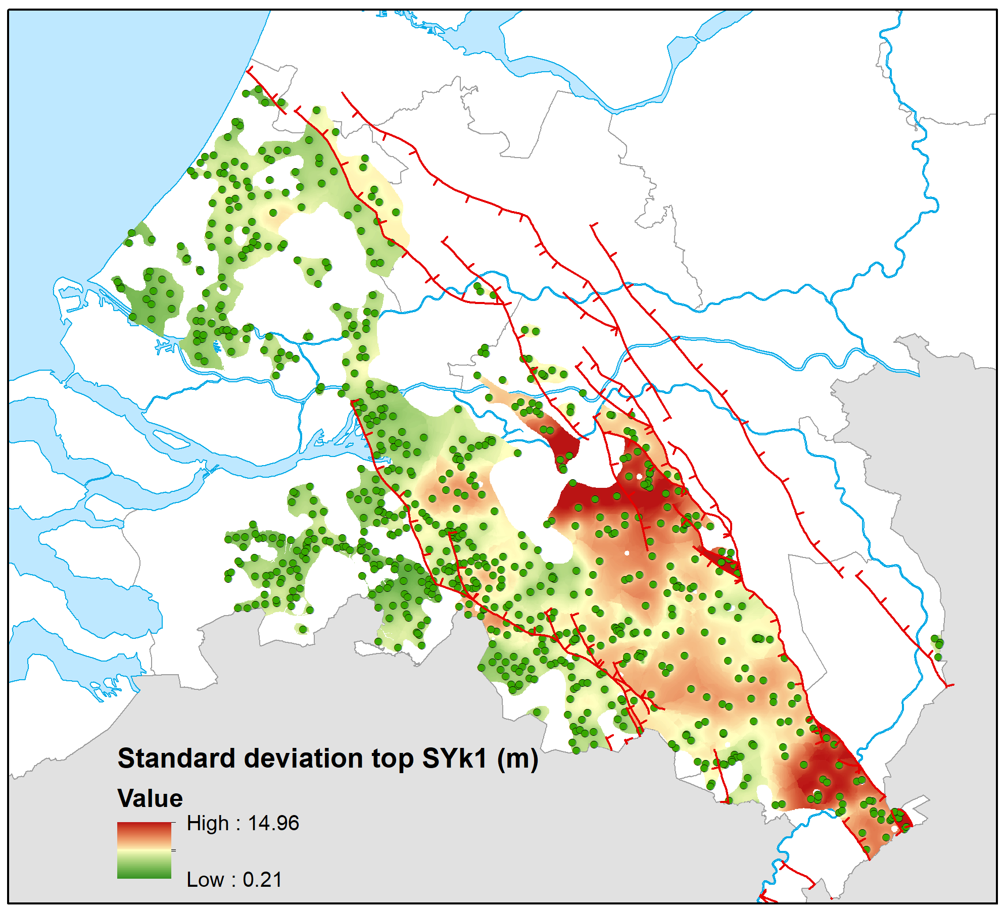
Model uncertainty of the top of the Stramproy Formation, first clayey unit (SYk1), expressed as a standard deviation (m). Green dots indicate the borehole locations where the unit is present.
Calculation of uncertainties in geometry
The geometry of the mapped hydrogeological units is calculated using a so-called kriging interpolation. Since modelling involves adding not only information from boreholes, but also additional hydrogeological knowledge, the kriging variance does not provide a useful measure of uncertainty. Therefore, a cross-validation-based method is used to determine the uncertainty.
Uncertainties are calculated only for mapped hydrogeological units. No uncertainties have been calculated from derived hydrogeological units (e.g. the 'sand layers').
Geometry and parameters remain the same
Uncertainties have been added to the existing model as new grids. The geometry (top, base and thickness) and the grids with hydraulic parameters (conductivity, hydraulic resistance and transmissivity) have not changed.
Want to know more?
The report Totstandkomingsrapport Kleine Release REGIS II (PDF in Dutch, 1,2 Mb) describes in detail the method used to calculate the uncertainties. This report is included in the model download. The same applies to the document kwaliteitstoetsingsdocument (PDF in Dutch, 78 Mb) which describes the Quality Control of this release. Further information on REGIS II can be found on the explanatory page of DINOloket.