The Geological Survey of The Netherlands-TNO developed new tools that map groundwater spatially and interactively. Although the tools are in Dutch; the terminology is almost similar to English. These new products are available at www.grondwatertools.nl:
- Isohypses tool (head contours)
- Groundwater dynamics tool
- Vertical tool ('Samenhangtool')
What do these tools have to offer?
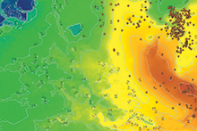
You can apply 'Grondwatertools' to get a quick insight national and regional problems concerning precipitation, evaporation, water permit requests e.g. All public groundwater level and data in the DINO repository are made available in 'Grondwatertools' within a day.
Share your experience
The 'Grondwatertools' are part of an exploration of the market. Further development will take place during 2018. Would you like to share your experience with 'Grondwatertools' or do you require more information? Contact us via this form.
A treasure-trove of information
Our mission is assisting the sustainable management of the Dutch subsurface. DINOloket is your source for our data and products and our knowledge and expertise is further made available at www.grondwatertools.nl. You can find additional information on this site to merely the 'Grondwatertools'. We have added a number of our applied maps and downloads that used to be available at www2.dinoloket.nl, for example the Geological Overview Map of The Netherlands, the brackish-salt map and the NL3D-model.